


Welcome to Sheringham Point Lighthouse
Sheringham Point Lighthouse is a designated National Heritage Lighthouse, located in Shirley, British Columbia. The Lighthouse is owned, operated and cared for by the Sheringham Point Lighthouse Preservation Society, a non-profit charity based in Shirley. The Lighthouse Site is open every day for the public to visit, enjoy and appreciate.
Please join with us and help protect the Lighthouse and its surrounding environment, as well as nearby features, for the benefit of the community. And help us ensure that this remarkable historical icon — a symbol of our shared heritage and care for one another — will continue standing tall and telling its stories for many generations to come.
What's New at the Lighthouse?

LATEST LIGHTHOUSE NEWS
SOCIETY MEETINGS & ACTIVITIES

VISITING THE LIGHTHOUSE
BREAKING NEWS...
LIGHTHOUSE BLOG - OUR LATEST POSTS
PHOTO OF THE WEEK


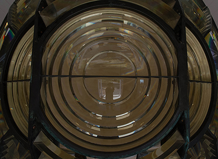
In Memoriam – Hon. Pat Carney
Hon. Pat Carney helps to unveil the plaque designating Sheringham Point Lighthouse a “National Heritage Lighthouse” On behalf of all the members of the Sheringham Point Lighthouse Preservation Society, we want to express our sadness, and offer our condolences, on hearing that our friend Pat Carney has passed away. Since…
New Lighthouse Trails Add New Lighthouse Views
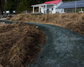
A view of the Lighthouse from the new Eastern Viewpoint. The Eastern Spur Trail crosses the marshy terrain in the lower field The Western Spur Trail winds among the trees at the western edge of the site During the late fall and early winter of 2022, the Sheringham Point Lighthouse…
LIGHTHOUSE “LIGHTS UP” AGAIN
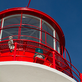
When Sheringham Point Lighthouse was first illuminated, in September of 1912, Eustace Arden lit an oil lamp to provide the light source for the 3rd Order Fresnel Lens that had been installed in the lantern room. The Fresnel Lens focused the light into a powerful beam that could be seen…